
Description
02
Intro
See Talstation Medrigjochbahn - Panoramarestaurant Bergbahn See, 19.80 km, 1145 m
Description
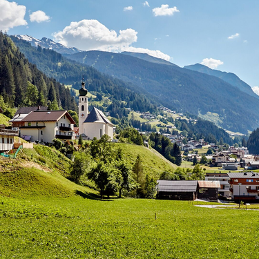
From See, the route leads through Kirchwald forest to the upper terminus of the Medrigjochbahn cable car. There you’ll reach the tree line and the Paznaun High Trail. Along gorgeous trails you follow the Paznaun High Trail, until you get into Flathtal Valley and run back to See along trails with short sections on the forest road.
Difficulty: Middle Length: 19.80 km Ascent: 1145 m Descent: 1145 m Highest Point: 1800 m Lowest Point: 1037 m Surface: Waldweg. Schotter Start: See Talstation Medrigjochbahn End: Panoramarestaurant Bergbahn See Height valley: 1037 Height mountain: 1800
Arrival
The autoroute (A12 (westbound) or A14 (eastbound)) leads you to the Arlbergschnellstraße (S 16). At the exit for Pians, turn onto the Paznauntalstraße (B 188) and follow its course into the Paznaun to the valley station of the cable car in See.
Parking
Parkingarea Medrigjochbahn See
Public transport
With the railway station in Landeck, the Paznaun is optimally connected to the Austrian train network. From Landeck-Zams station, only a short bus ride separates you from the Paznaun. Every half an hour, line bus 260 runs from there through the valley. Bus stop: See Dorf/Bergbahn
Equipment
Trailrunning Schuhe, Regen- und Windschutz, Stöcke


