


Up to the minute
Weather today
Temperature
15 °C / 24 °C
Sunshine hours
7 h


Weather forecast for Kappl
How’s the weather?
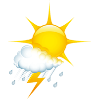
A summer high-pressure system will largely determine the weather across the country over the next few days and into the new week. As a result, the sun should make frequent appearances. It will shine for longer periods, especially in the mornings. However, in the often hot air mass and due to strong solar radiation, cumulus clouds will repeatedly form over the mountains in the afternoons and could grow quite large. Therefore, isolated thermal thunderstorms cannot be ruled out. Because of the heat, these storms have stored a lot of energy and could therefore be more intense in some areas. A significant shift to cool and rainy weather is not expected in the long term.
CURRENT WEATHER SITUATION
LIVE from KAPPL
table.scrollable
Live from Kappl
CURRENT KAPPL WEATHER SITUATION
Your stay in Kappl is approaching - now it's time to pack your bags! Important now: a precise weather forecast. But in Kappl, no weather forecaster is needed. The latest data and live images are available via webcam .


Stay Tuned & Stay involved
What inspires – and what matters